Aller au contenu
Choix par tâche

Record a walk or an easy hike, see the exact distance, elevation gain and time, without draining the phone to zero. Often this is also a way to track recovery after an injury or to stay in shape.

Randonnées et itinéraires

Les textes sur les apps sont en anglais.

People just counting their kilometers

Quelles apps les gens utilisent

Ces apps sont mentionnées dans le décryptage de cette tâche. Ouvre chacune pour comparer les points forts et les limites. L’ordre de la liste n’est pas un classement d’adéquation.

  1. Walkmeter Walking & Hiking GPS

    Rang 16. Note des avis : 48 sur 100. Note sur l’App Store : 4,7★ · 13 355 notes

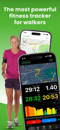
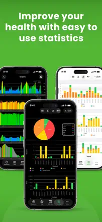
    People keep Walkmeter for years for a depth of data and control others lack, some logging thousands of miles over a decade, and it genuinely motivates them to walk. But tracking stops on its own mid-walk with no sound, mileage swings on the very same route, and on top of that aggressive ads creep in, even porn and fake virus warnings, which infuriates paying users.

    Points forts : Depth of data and level of control, years of accumulated stats and miles, motivates regular walking, solid sensor work and route creation

    Reproches : Tracking stops mid-walk with no sound, mileage swings on the same route, aggressive ads including porn and fake virus warnings, unreliable watch link after updates, hard to use with no instructions

    Pour qui : Walkers and regular-exercise folks who care about deep stats and control over their data

  2. Footpath Route Planner

    Rang 8. Note des avis : 60 sur 100. Note sur l’App Store : 4,8★ · 21 582 notes

    Footpath is loved for exactly what people get it for, drawing a route with your finger and instantly seeing the mileage, perfect for runners prepping for a distance in an unfamiliar city, and the iPad drawing is called excellent. It breaks on reliability, after updates it gets stuck on the splash screen, freezes and loses drawn routes, and navigation and offline maps are locked behind the paid version.

    Points forts : Finger-drawing a route with instant mileage, planning runs for a specific distance, excellent drawing on iPad, simple and clear planner

    Reproches : Stuck on splash screen after updates and won't launch, freezes and loses drawn routes, navigation and offline maps paid only, route doesn't sync between watch and iPhone, support doesn't reply

    Pour qui : Runners and cyclists who need to draw a route for a target distance and see the mileage

  3. Topo Map & Hiking Tracker

    Rang 13. Note des avis : 52 sur 100. Note sur l’App Store : 4,7★ · 1 357 notes

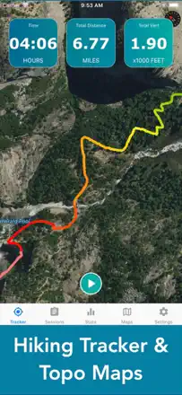
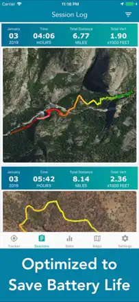
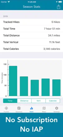
    People value it for no subscription and no ads, an honest one-time purchase, simplicity and a smart battery-saving mode via airplane mode with a preloaded map. But one problem hits the core: distance tracking consistently overstates mileage, people get 8 miles instead of 7 or 18 instead of 14, which is critical for a tracker. It also does not sum total elevation gain across multiple climbs, does not save calories and elevation to the saved map, and for some the map goes black after 10 minutes.

    Points forts : No subscription and no ads, honest one-time purchase, simple and clear, battery saving via airplane mode with a preloaded map, works in the background, several topo maps to choose from, affordable price

    Reproches : Distance tracking consistently overstates mileage by miles, does not sum total elevation gain across multiple climbs, does not save calories and elevation to the saved map, map goes black after 10 minutes for some, cannot import waypoints, no compass

    Pour qui : For those who want a simple hike tracker with no subscription and no ads for a one-time fee, and who do not need distance accuracy to the tenth of a mile

  4. Tomstrails GPS UTM

    Rang 9. Note des avis : 60 sur 100. Note sur l’App Store : 4,8★ · 1 588 notes

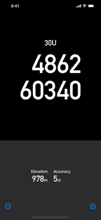
    A simple narrow utility: it shows UTM or latitude-longitude for working with a paper topo map with no signal, and it does that accurately, including an airplane mode to save battery in the wild. Those who understand its purpose praise the accuracy of the 8-digit grid and the responsive author. Its weak spot is that many fives are empty and generic, some complain coordinate formats are buried in a menu, and after an iOS update the app stopped working for a few people.

    Points forts : Accurate UTM coordinates for paper maps, works without signal in airplane mode, saves battery, simple and fast, responsive author adds datums on request, accurate 8-digit grid

    Reproches : Many fives are empty and generic, coordinate formats buried in a menu or unavailable, stopped working after an iOS update, charges extra for full features that only add an azimuth readout, narrow functionality with no map

    Pour qui : For those who hike with a paper topo map and compass and want only coordinates with no internet, for grid navigation and emergencies

Autres besoins de ce thème

Classement complet : Randonnées et itinéraires25 apps avec captures et notesD’où vient ce décryptageLire l’étude et les observations tirées des avis