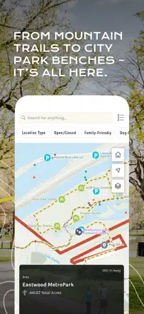
Where the downloaded map honestly works offline and keeps you from getting lost, and where it crashes on the trail and drains the battery. The highest review-text scores: AllTrails (78/100), WorkOutDoors (78), and Cairn (78).
Review score: 78 out of 100. App Store rating: 4.9★ · 1,031,943 ratings
78of 100
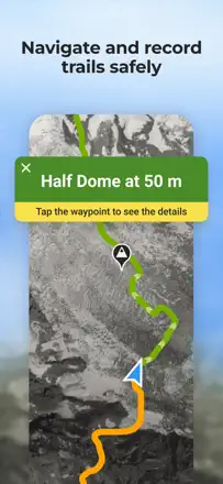
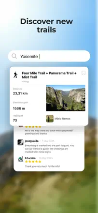
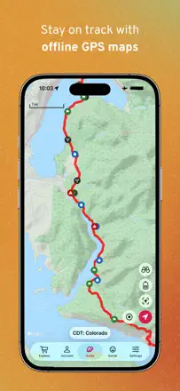
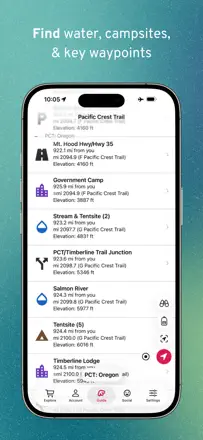
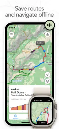
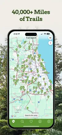
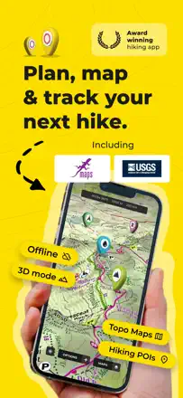
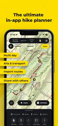
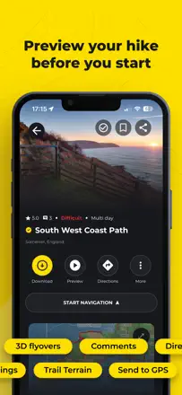
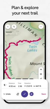
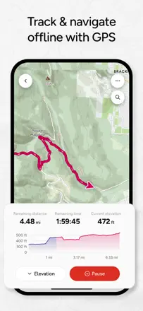
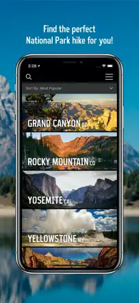
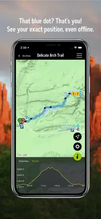
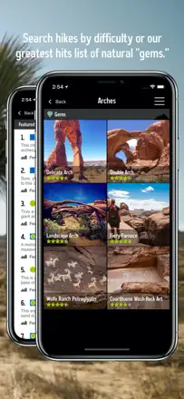
People keep AllTrails as their single reference for planning a hike and value the offline maps, elevation profile, length and duration, plus reviews and photos from those who already walked the trail. It breaks on the new interface that hides basic things from free users, on crashes and phone overheating during long navigation, and on a murky cancellation where the charge lands before the trial ends.
Praised
Offline maps where there is no signal, elevation profile and trail duration, reviews and photos from prior hikers, everything in one planning reference
Complaints
New interface hides basic features from free users, crashes and overheating on long navigation, murky cancellation and charge after trial, search jumps back to top of list, AI slop in trail descriptions
Best for: Hikers and runners who want one reference with maps, elevation and living trail reviews
Review score: 78 out of 100. App Store rating: 4.7★ · 1,668 ratings
78of 100
Data lovers adore it for bottomless customization: any metric on the watch face, intervals with voice cues, external heart-rate monitor, watch faces tuned to your numbers. People even drop Garmin and buy an Apple Watch just for it, and support is responsive. The flip side of that power: a mountain of settings with no documentation scares off newcomers, there are Bluetooth issues (no more than two devices) and complaints about Tip Jar charges, and the complex interface needs a deep dive at the start.
Praised
Endless customization of metrics and watch faces, intervals with voice cues, external heart-rate monitor, battery saving, responsive support, people switch from Garmin for it, no ads
Complaints
A mountain of settings with no documentation scares off newcomers, Bluetooth glitches and a two-device error, complaints about Tip Jar charges, heavy cluttered interface, cannot build routes inside without Strava, drains battery over long distances
Best for: For data and metric lovers on Apple Watch who will spend time configuring for full control over a workout, runners and hikers
Review score: 78 out of 100. App Store rating: 4.7★ · 533 ratings
78of 100
People pick Cairn for their family's peace of mind: auto-alerts with your last coordinates if you are overdue, and the cell-coverage map are genuinely valued by solo hikers. The weak spot is the core thing itself: tracking sometimes silently stops mid-hike and it crashes offline, and the trail you need is sometimes just missing from the database.
Praised
Auto-alerts to family with coordinates, cell-coverage map, peace of mind for family, offline maps ahead of time, route and elevation-gain tracking
Complaints
Tracking stops on its own mid-hike, crashes in offline mode, needed trail missing from database, rigid list of return times instead of your own
Best for: Solo hikers and their loved ones who need family to know the route and last location
Rank 4. Review score: 68 out of 100. App Store rating: 4.8★ · 5,224 ratings
68of 100
A huge worldwide database of trails people stick with for years, especially for moto, horse and hiking routes in places where nothing else exists. It breaks on interface details: constant re-login prompts on filters, no button to center on your location, search returns hundreds of irrelevant hits. After recent updates some users see GPS drawing the track as straight lines and inflating distance.
Praised: Massive worldwide route database, works for moto and horse trails, precise track recording, people stay on Pro for years, finds trails where everything around is private land
Complaints: Makes you log in again and again on filters, no button to center on your location, search returns hundreds of irrelevant results, after updates GPS draws straight lines and inflates distance, offline maps download slowly
Best for: For those hunting trails in remote spots worldwide, for hiking, horse and moto trips, who can tolerate clunky search for the coverage
Rank 5. Review score: 68 out of 100. App Store rating: 4.6★ · 538 ratings
68of 100
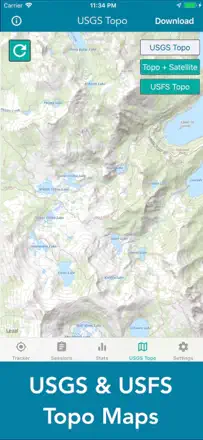
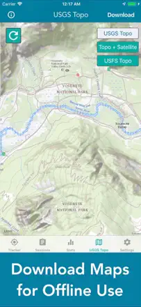
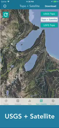
Readable topo maps and offline access genuinely help where there is no signal, and the developer replies and fixes issues right in the reviews. It breaks on tile downloads and after updates: people lose their paid pro version, tiles fail to finish downloading, and mileage is off.
Rank 6. Review score: 62 out of 100. App Store rating: 4.8★ · 26,183 ratings
62of 100
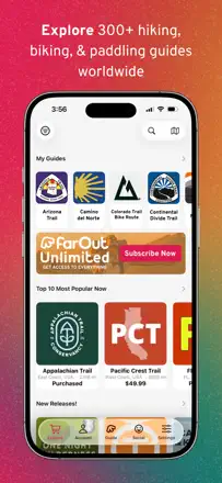
FarOut, formerly Guthook, is indispensable on thru-hikes like the Appalachian Trail for its water points, bear and campsite markers, and fresh comments from people who just passed, plus you buy maps once with no subscription. It breaks right where it matters most, the app freezes and crashes on multi-day trips, the offline map sometimes won't open without signal, and an update can lose trail sections you already bought.
Praised: Water points and bear and campsite markers, fresh comments from people who just walked it, buy a map once with no subscription, view with map, elevation profile and waypoint list
Complaints: Freezes and crashes on multi-day trips, offline map sometimes won't open without signal, updates lose purchased trail sections, fewer fresh comments now, planning a route on the phone is awkward
Best for: Thru-hikers and paddlers on long routes who need water points and live reports from the trail
Rank 7. Review score: 62 out of 100. App Store rating: 4.9★ · 2,177 ratings
62of 100
People adore the WTA organization itself and its trip reports: snow, washouts, road conditions and closures before you head out are the best thing about Washington hiking. But the app lets them down: for the past year it crashes the moment you try to search, trip reports do not sync, and gray text on a pale background is unreadable in sunlight. Many end up using the website on a computer instead.
Praised: Trip reports on snow, washouts and road conditions, best coverage for Washington and PNW, free, no ads, clean pleasant interface, sense of community
Complaints: Crashes on search for the past year, trip reports do not sync from the app, gray text on pale background unreadable in sun, tiny text with no dynamic type support, forces a password every launch
Best for: For hikers in Washington who want fresh trail condition reports before heading out, willing to tolerate crashes and fall back to the website when the app dies
Rank 8. Review score: 60 out of 100. App Store rating: 4.8★ · 21,582 ratings
60of 100
Footpath is loved for exactly what people get it for, drawing a route with your finger and instantly seeing the mileage, perfect for runners prepping for a distance in an unfamiliar city, and the iPad drawing is called excellent. It breaks on reliability, after updates it gets stuck on the splash screen, freezes and loses drawn routes, and navigation and offline maps are locked behind the paid version.
Praised: Finger-drawing a route with instant mileage, planning runs for a specific distance, excellent drawing on iPad, simple and clear planner
Complaints: Stuck on splash screen after updates and won't launch, freezes and loses drawn routes, navigation and offline maps paid only, route doesn't sync between watch and iPhone, support doesn't reply
Best for: Runners and cyclists who need to draw a route for a target distance and see the mileage
Rank 9. Review score: 60 out of 100. App Store rating: 4.8★ · 1,588 ratings
60of 100
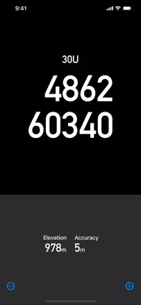
A simple narrow utility: it shows UTM or latitude-longitude for working with a paper topo map with no signal, and it does that accurately, including an airplane mode to save battery in the wild. Those who understand its purpose praise the accuracy of the 8-digit grid and the responsive author. Its weak spot is that many fives are empty and generic, some complain coordinate formats are buried in a menu, and after an iOS update the app stopped working for a few people.
Praised: Accurate UTM coordinates for paper maps, works without signal in airplane mode, saves battery, simple and fast, responsive author adds datums on request, accurate 8-digit grid
Complaints: Many fives are empty and generic, coordinate formats buried in a menu or unavailable, stopped working after an iOS update, charges extra for full features that only add an azimuth readout, narrow functionality with no map
Best for: For those who hike with a paper topo map and compass and want only coordinates with no internet, for grid navigation and emergencies
Rank 10. Review score: 58 out of 100. App Store rating: 4.6★ · 7,882 ratings
58of 100
TrailLink is good for rail-trails and bike paths, inspiring people to find routes nearby and discover hidden spots on a familiar trail. But the database is incomplete, many people see only a couple of trails nearby out of dozens that actually exist, there's no proper GPS guidance on the route after you park, and some paid users can't unlock premium features for years.
Praised: Solid database of rail-trails and bike paths, inspires finding routes nearby, reveals hidden spots on a familiar trail, handy for milestones and tracking progress
Complaints: Incomplete database, shows only a couple of trails nearby out of dozens, no GPS guidance on the route after parking, paid access won't unlock premium features for years, no full-screen view on tablet
Best for: Cyclists and walkers who need rail-trails and bike paths nearby
Rank 11. Review score: 55 out of 100. App Store rating: 4.8★ · 126,349 ratings
55of 100
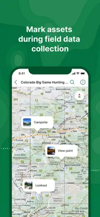
Avenza is loved by firefighters, hunters and people who carry georeferenced maps as a paper replacement, for its accurate GPS and easy import of historic aerials and USGS maps. It fell apart when custom map import got locked out of the free version, breaking many people's usual workflow, plus map search is clumsy and the field-notes interface is heavy.
Praised: Georeferenced maps as a paper replacement, accurate GPS even on free, importing USGS maps and historic aerials, fast offline map downloads
Complaints: Custom map import removed from free version, clumsy search for the map you want, heavy field-notes interface, cap on number of imported maps, coordinate entry autocorrect breaks navigation
Best for: Firefighters, hunters and field professionals who need their own georeferenced maps offline
Rank 12. Review score: 55 out of 100. App Store rating: 4.8★ · 5,968 ratings
55of 100
OnX Backcountry is praised for its clear layout, offline maps with no fear of losing signal, and frequent free layers, and some prefer it over AllTrails and Gaia. But in-app route building is finicky, it drops points on its own and won't let you remove them, the trail database is sometimes thinner than AllTrails, and the company splits features across separate paid apps while burying you in offer pop-ups and rating prompts.
Praised: Clear and fast layout, offline maps with no fear of losing signal, accuracy on the route, building your own route with a feasibility check
Complaints: Route builder drops points on its own and won't let you remove them, trail database sometimes thinner than AllTrails, features split across separate paid apps, search fails to find popular trails, buries you in offer and rating pop-ups
Best for: Off-roaders and hikers who need offline maps and land-ownership data in the backcountry
Rank 13. Review score: 52 out of 100. App Store rating: 4.7★ · 1,357 ratings
52of 100
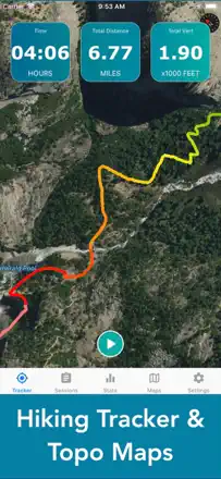
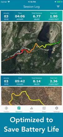
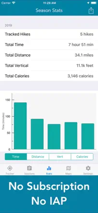
People value it for no subscription and no ads, an honest one-time purchase, simplicity and a smart battery-saving mode via airplane mode with a preloaded map. But one problem hits the core: distance tracking consistently overstates mileage, people get 8 miles instead of 7 or 18 instead of 14, which is critical for a tracker. It also does not sum total elevation gain across multiple climbs, does not save calories and elevation to the saved map, and for some the map goes black after 10 minutes.
Praised: No subscription and no ads, honest one-time purchase, simple and clear, battery saving via airplane mode with a preloaded map, works in the background, several topo maps to choose from, affordable price
Complaints: Distance tracking consistently overstates mileage by miles, does not sum total elevation gain across multiple climbs, does not save calories and elevation to the saved map, map goes black after 10 minutes for some, cannot import waypoints, no compass
Best for: For those who want a simple hike tracker with no subscription and no ads for a one-time fee, and who do not need distance accuracy to the tenth of a mile
Rank 14. Review score: 52 out of 100. App Store rating: 4.8★ · 359 ratings
52of 100
People love Outdoor Afro for its real community: you can follow local leaders, visit spots they have vetted, and join group outings, which trail-map trackers lack. But as a Meetup replacement it fails: nearby events do not show up in the feed, you cannot filter by location (events from other states appear), there are no notifications, and the waiver form gets stuck.
Praised: Real community and group outings, following local leaders, spots they have vetted, online waiver signing instead of the old Meetup process, easy trip sign-up
Complaints: Nearby events do not show in the feed, no location filter (other states creep in), no notifications for new events or moving off the waitlist, the waiver form gets stuck
Best for: People looking for a real community and group outdoor outings, not just a trail map
Rank 15. Review score: 50 out of 100. App Store rating: 4.7★ · 8,601 ratings
50of 100
Komoot is valued as a strong route planner with accurate maps and export to devices like Wahoo, and it's genuinely handy for travel and cycling. But after Bending Spoons bought it everything changed, veterans have to relearn planning, purchased map packs are nearly useless without a subscription, and every tap tries to push a free trial. On top of that route privacy isn't the default and there's no dedicated walking mode.
Praised: Accurate maps and clear directions, exporting routes to devices like Wahoo, strong planner for cycling and travel, works for cyclists and runners
Complaints: Bending Spoons takeover broke the familiar planning, purchased map packs useless without a subscription, every tap pushes a free trial, route privacy isn't the default, no dedicated walking mode
Best for: Cyclists and travelers who plan routes and export them to bike computers
Rank 16. Review score: 48 out of 100. App Store rating: 4.7★ · 13,355 ratings
48of 100
People keep Walkmeter for years for a depth of data and control others lack, some logging thousands of miles over a decade, and it genuinely motivates them to walk. But tracking stops on its own mid-walk with no sound, mileage swings on the very same route, and on top of that aggressive ads creep in, even porn and fake virus warnings, which infuriates paying users.
Praised: Depth of data and level of control, years of accumulated stats and miles, motivates regular walking, solid sensor work and route creation
Complaints: Tracking stops mid-walk with no sound, mileage swings on the same route, aggressive ads including porn and fake virus warnings, unreliable watch link after updates, hard to use with no instructions
Best for: Walkers and regular-exercise folks who care about deep stats and control over their data
Rank 17. Review score: 48 out of 100. App Store rating: 4.6★ · 939 ratings
48of 100
People use it for planning long routes and previewing trails, some like coverage such as Purple Lizard in Pennsylvania and the free planning. But serious problems repeat: recorded hikes do not sync and disappear, support replies once then goes silent, elevation profiles are wrong, trail difficulty ratings are odd. Plus the interface is busy, the trail inventory is smaller than competitors, and distance is in kilometers only with no miles.
Praised: Planning long routes and previewing trails, shows campgrounds during planning, good coverage in some regions, free planning, keeps you on the right trail
Complaints: Recorded hikes do not sync and disappear, support replies once then goes silent, wrong elevation profiles and odd difficulty ratings, busy interface, fewer trails than competitors, distance in kilometers only, promotional notifications
Best for: For those planning long routes who want free planning with trail previews, willing to keep a second app or a paper guide alongside for navigation
Rank 18. Review score: 48 out of 100. App Store rating: 4.7★ · 426 ratings
48of 100
Ordnance Survey cartography is second to none for everyone, especially for walking around Britain, and the offline mode saves you in rain and on windy cliffs. But the app around the maps falls apart: it constantly logs you out and makes you re-download, it crashes when you zoom on your own downloaded maps, and cancelling the subscription was made nearly impossible.
Praised: Unmatched Ordnance Survey maps, detail and accuracy, offline mode in rain and wind, rights-of-way over land
Complaints: Constantly logs you out and demands re-downloads, crashes when zooming on offline maps, unreliable during server outages, nearly impossible to cancel the subscription
Best for: Hikers across Britain who need official OS maps and offline access in the wild
Rank 19. Review score: 45 out of 100. App Store rating: 4.6★ · 2,812 ratings
45of 100
People buy it for topo maps and tracking, for some it replaced a discontinued trails app and genuinely helps offline. But the main complaint repeats: zoom in to a useful scale and all topo detail and contour lines vanish, leaving a green screen with roads. Offline maps download through awkward pan-and-zoom over tiles instead of a simple box select, and there is no compass or center-on-me.
Praised: Good topo maps and GPS tracking, helps offline with no signal, simple intuitive controls, on-screen prompts, replacement for a discontinued trails app
Complaints: Topo detail and contour lines disappear on zoom, offline maps download by painful tile-by-tile panning, no compass or heading orientation, no center-on-me button, loses tracked miles on a tracking failure
Best for: For those who want a cheap topo map for a hike and can tolerate clumsy offline downloads, not for serious backcountry navigation
Rank 20. Review score: 42 out of 100. App Store rating: 4.8★ · 69,457 ratings
42of 100
Relive hooks people by turning a hike or ride into a nice route video with photos and stats, and people genuinely enjoy making them. But the team keeps cutting features one by one and hiding them behind the paid version, they removed route trimming so recording drags on all the way to the car, auto-pause won't resume on its own, and videos got capped at 60 seconds, so long-time fans are leaving.
Praised: Nice route videos with photos and stats, stats like top speed and elevation gain, music in videos, easy clip creation after a hike
Complaints: Route trimming removed, auto-pause won't resume by itself, videos capped at 60 seconds, stats stripped from free videos, charge after trial with no warning
Best for: Hikers and cyclists who want to save and show off a route as a nice video clip
Rank 21. Review score: 42 out of 100. App Store rating: 4.5★ · 1,455 ratings
42of 100
People love it for finding less crowded trails in national parks, route details, difficulty ratings and offline use in dead zones. But right now basemaps just do not load for many as the hiking season starts, and after the latest update the app crashes the moment you open it. Plus the catalog is incomplete: whole parks and trails are missing, some webcams have been down for years, and you cannot get in without creating an account.
Praised: Finds less crowded trails and hidden gems in national parks, route detail and difficulty ratings, works offline in dead zones, easy to pick family-friendly trails, pleasant layout
Complaints: Basemaps do not load, crashes on open after the update, incomplete catalog with missing parks and trails, some webcams down for years, cannot log in without creating an account, support links to a different app's website
Best for: For those planning US national park trips who want to find less crowded trails with detail and offline maps, if the app works at all right now
Rank 22. Review score: 42 out of 100. App Store rating: 4.3★ · 431 ratings
42of 100
Those who got the hang of it value drawing their own routes, exporting .gpx for Garmin, and 3D route videos. But after the ViewRanger takeover the app became complicated and unreliable: lifetime users had their paid maps cut off, it overheats the phone and drains the battery, and support does not reply.
Praised: Drawing your own routes, .gpx export for Garmin, 3D route videos, detailed maps
Complaints: Features lost after ViewRanger, paid lifetime maps disabled, overheating and battery drain, silent support, cannot reset password
Best for: People willing to learn it and draw their own routes, but not former ViewRanger users with a lifetime purchase
Rank 23. Review score: 40 out of 100. App Store rating: 4.8★ · 32,050 ratings
40of 100
Gaia is valued for some of the best maps for off-roading and overlanding and for genuinely bailing people out at junctions with no signal. But after Outside bought the company things regressed, they removed the beloved Nat Geo Trails and satellite layers, snap-to-trail doesn't hold offline, and since the June update the app crashes constantly, so people are moving to onX and others.
Praised: Some of the best maps for off-roading and overlanding, USGS Topo layer, saves you at junctions with no signal, accuracy on the route
Complaints: Constant crashes since the June update, removed Nat Geo Trails and satellite layers, snap-to-trail fails offline, slow and painful offline map downloads, elevation gain estimate off by 30-50%
Best for: Off-roaders and overlanders who need detailed topo maps offline in the backcountry
Rank 24. Review score: 40 out of 100. App Store rating: 4.5★ · 1,973 ratings
40of 100
It used to be a beloved free app from the REI era, simple with great tracking and driving directions right to the trailhead. After OnX bought it many say it turned into an ad wrapper and started crashing on launch on newer iPhones. Offline barely works, maps do not load without signal, search is weak, and saved maps vanished for people after an update.
Praised: Free, great route tracking, accurate trail detail and elevation profile, driving directions to the trailhead, legacy of REI-era simplicity
Complaints: Crashes on launch on newer iPhones, offline barely works and maps do not load without signal, became an ad wrapper after the OnX purchase, weak search and many missing trails, no kml/kmz import or gpx export, lag on zoom
Best for: For those who remember it from the REI days and want free tracking with directions to the trailhead, if the app even launches on their phone
Rank 25. Review score: 28 out of 100. App Store rating: 4.5★ · 863 ratings
28of 100
Map lovers like the idea: the app shows secondary trails and hidden park corners missing from regular maps, and in a couple of parks like the Crosstown Trail in San Francisco it genuinely helps. But execution fails hard: for many the email-code login just does not work, and the app crashes on a screen tap or freezes on points with no details. Plus invasive data collection by default, tiny non-adjustable font, the trail disappears and you have to search for it again, and no iPad version.
Praised: Shows secondary trails and hidden park corners missing from regular maps, pleasant map, helps in specific parks, responsive developer fixes issues on contact
Complaints: Email-code login does not work, crashes on a screen tap and freezes on points with no details, invasive data collection by default, tiny non-adjustable font, the trail disappears and must be searched again, no iPad version, sparse data
Best for: For those exploring a specific park or state program where this app is officially used, and willing to tolerate login trouble and crashes
About scores
Two scores — two sources
They help compare apps, but they don’t replace checking your own job.
Review score · up to 100
The stored score from inApp research on review texts. It rates the app overall in the archive, not the reliability of any one feature.
Store rating · up to 5
The rating from the app’s page when the data was collected. The current rating and version may differ.
In the archived sample for this topic: 25 apps and 8,523 reviews read. That is the total size of the research, not the number of reviews per app.
A gap between the scores doesn’t prove manipulation. The calculation date and the full scoring method aren’t in the mobile archive. Compare the job descriptions and the source quotes, and check the terms in the current version.